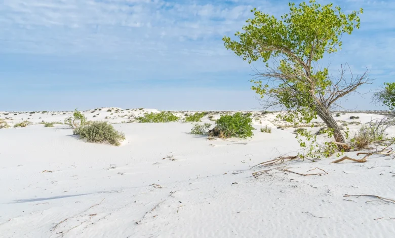
Before the white dunes, there was a lake. During the Last Glacial Maximum, Lake Otero filled much of New Mexico’s Tularosa Basin, and people walked its muddy shore, leaving the footprints that made White Sands world-famous. Research published in Science Advances now reconstructs that lake’s behaviour, and finds its shores shifted abruptly, repeatedly changing the world its human visitors knew.
The evidence lies in sediment cores drawn from the old lakebed. Layer by layer, the mud records water depth, salinity and the wash of sediment from surrounding hills. Radiocarbon dates place those layers in time, producing a continuous environmental history across the exact period when the footprint trails were made.
Steps instead of slopes
The headline finding is the tempo. Rather than easing gradually from Ice Age conditions towards modern ones, Lake Otero flipped between states: fuller and fresher phases, then leaner and more saline ones, with transitions short enough to matter within human lifetimes. A shoreline is infrastructure for a hunter-gatherer community; when it moves kilometres, camps, hunting routes and gathering grounds must move too.
Scientists cross-check the story in the chemistry of each layer and in the microscopic remains of lake organisms, which are fussy about the water they live in and therefore honest witnesses. The study appears in Science Advances.
The human meaning of a restless lake
It would be easy to file the result under climate trivia. Its real weight is human. The footprint trails at White Sands include adults, teenagers and children, family groups crossing the shore, sometimes near the tracks of giant sloths. Those families were not living in a museum of stable Ice Age life; they were managing change as a routine condition, carrying knowledge of multiple shorelines and fallback resources.
That reframing strengthens the site’s importance. White Sands no longer shows only that people arrived early; it shows how they lived once there, adaptive and mobile in a demanding basin. Evidence that revises a settled picture is a thread through much of our general coverage, from this research to studies such as Smartphone Bans at School Linked to Stronger Exam Results.
Open questions in the mud
Next, researchers want to know the flips’ exact speed and reach: did the whole lake change at once, and did neighbouring valleys feel the same shocks? More cores and tighter dating will answer both. Each core is cheap compared with its yield, a long tube of mud that behaves like a flight recorder for a vanished lake. White Sands began as a story about footprints. It is becoming a story about the moving world that received them, and about people who learned to keep pace with it.
Methods still to be applied at the site
The research frontier at White Sands is methodological as much as geographical. Sedimentary ancient DNA could identify species, possibly including humans, from layers that hold no bones or artefacts. Finer luminescence dating may compress the uncertainty around individual footprint horizons. Pollen and phytolith analysis can name the plants edging each shoreline, converting an abstract water level into a menu of foods, fibres and fuels available to the people living there.
Each technique imports its own controversies, and the site’s history of bold claims guarantees scrutiny, which is healthy. What is not in doubt is the direction of travel: every added method has made the picture sharper rather than blurrier, and the emerging portrait, of people persisting through abrupt environmental change at the end of the Ice Age, is more interesting than the static one it replaced. Further seasons of coring and analysis are expected to test, and very likely extend, that portrait.
Preservation gives the site one more advantage researchers intend to exploit: the gypsum chemistry that saved the footprints also protects organic material in the surrounding sediments unusually well. That raises the prospect of recovering seasonal detail, pollen released in particular springs, flood layers from particular storms, far finer than the century-scale resolution that already transformed interpretation. A record that can speak in seasons as well as centuries would let archaeologists ask how individual years of hardship or plenty were distributed within the longer flips, bringing the reconstruction closer to lived experience than deep-time studies usually manage.